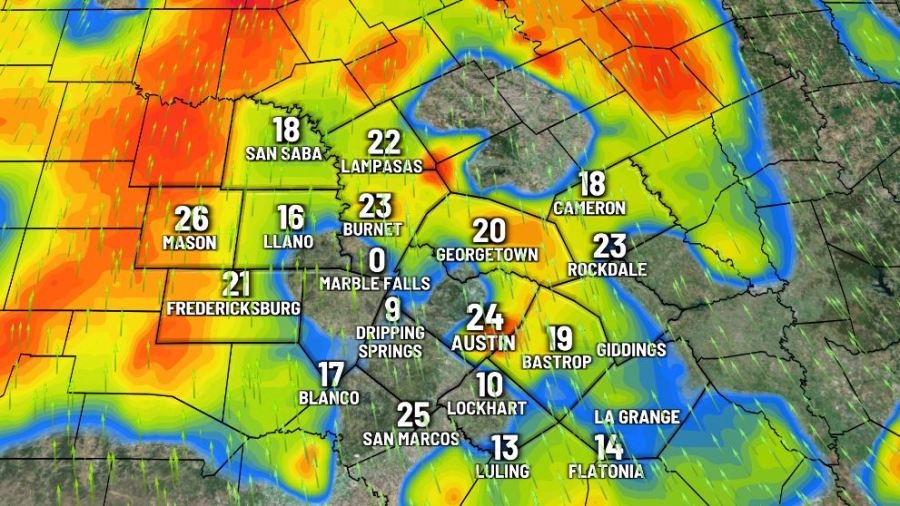

AUSTIN (KXAN) — Warm, humid and breezy conditions to start our Friday ahead of what is likely to be a very active afternoon and evening.
Between 5 p.m. – 10 p.m. tonight, a significant severe weather threat will develop bringing the highest risk of tornadoes in our area since March, when we saw the tornado outbreak. Read details on the storm timing and where the threat is the highest below.


Rain clears in time for a gorgeous autumn weekend with chilly mornings and pleasant days. After we set our clocks back an hour early Sunday morning, warmth and humidity returns. A few spotty showers are possible Monday, but there is no severe risk at this time.
FIRST WARNING WEATHER: Stay up to date with your Central Texas forecast, sign up for our weather newsletter at kxan.com/newsletters
Summer Heat
Meteorological summer ended on Aug. 31, as Camp Mabry recorded its second-hottest summer in recorded history. Austin-Bergstrom recorded its 7th-hottest summer on record.
Sign up for our daily forecast newsletter at kxan.com/newsletters. Download the KXAN Weather app to get the latest weather forecast: Apple | Android
___________________________________________________________________________________________
Follow the KXAN First Warning Weather team on Facebook, Twitter and Instagram.
You can also follow our meteorologists’ individual accounts for livestreams and a little bit of what goes on behind the scenes: